
Walk a Yakima Street
A reliable street-by-street search starts with the physical, or situs, address. Preserve its original spelling, directional words, and street number. Make a second version without punctuation and shorten the street type to forms such as Ave or St. The Yakima County Assessor Property Search can then supply the parcel number, owner display, abbreviated legal description, tax-code area, and excise clues. Those fields are a starting point, not a household list.
Once the parcel is known, maps and records can be joined without guessing from a similar name. Use this order:
- Search the Assessor by situs address. If the full text fails, remove punctuation and try the house number plus street name.
- Open the parcel in CityMap or the County Parcel Viewer. Confirm jurisdiction, adjoining parcels, and the displayed layers.
- Check city SmartGov or county permit sources by address or parcel. Label applicants, contractors, contacts, and owners by their actual roles.
- Carry an excise number, owner name, parcel, or legal description into the Auditor's recorded-document system. Inspect the document image when available.
- For civic or historical occupancy evidence, use the voter-file request or a dated criss-cross directory. Never turn a dated hit into a claim of current residence.
This Yakima street directory workflow keeps ownership, occupancy, and postal delivery separate. It also gives each conclusion a date and a source.
Search Yakima Street Parcels
The Assessor portal accepts either a parcel number or a situs-address string. It asks for at least three characters for a situs query and advises users to omit punctuation. Less text often works better. Results can be sorted by parcel number, owner name, or situs address, which makes it practical to inspect a short run of addresses rather than search one parcel in isolation.
| Portal control | Input | Yakima search rule | Result |
|---|---|---|---|
| Search String | Free text | Use at least three characters for situs; remove punctuation | Accepts the selected parcel or street query |
| Parcel Number | Radio choice | County guidance calls for at least six digits | Finds the parcel key |
| Situs Address | Radio choice | Use number, street name, and short street type | Returns sortable parcel, owner, and situs rows |
| Detail tabs | Record views | Open the relevant tab after choosing a parcel | Property, excise, tax, value, photo, and segregation details |
A parcel detail can include use, acreage, neighborhood, building facts, utilities, zoning, values, and an abbreviated legal description. Some tabs have no data, and government-exempt parcels may omit levy or value facts. The Treasurer remains the source for the current tax bill. The Assessor record is also not a deed certification or a guarantee of present occupancy.
The live Yakima County Assessor search is shown below. Its simple controls are useful when a long, fully formatted address produces no match.
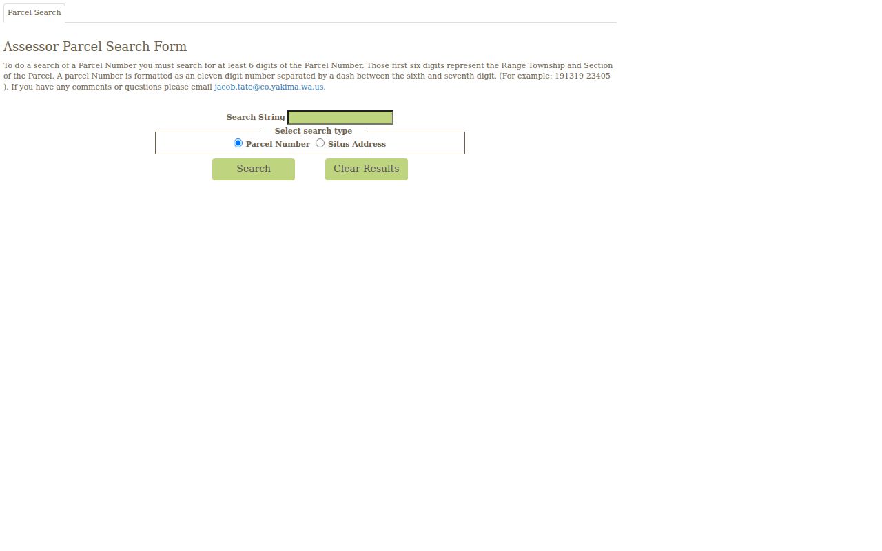
The screenshot links to the official portal. Record the date searched because parcel displays and values can change.
Yakima Street Record Layers
No single Yakima street directory contains every useful address record. The same street may appear in county, city, postal, election, and historical systems. The best source depends on whether the question concerns a parcel, a document, a project, or a dated person listing.
| Address source | Keeper | What the record can show | Access route |
|---|---|---|---|
| Assessor parcel card | Yakima County Assessor | Parcel, situs, owner display, use, site facts, and excise pointers | Free online search or Room 112 |
| Parcel and planning maps | County GIS or City Planning | Boundaries, jurisdiction, nearby parcels, zoning, and selected overlays | County Parcel Viewer and CityMap |
| Recorded deed, plat, or easement | Yakima County Auditor | Parties, legal description, instrument date, and recorded interest | Online index/vendor, Room 117, mail, or microfilm |
| Permit or notice | County divisions or City SmartGov | Project, application address, applicant, owner, contractor, status, and inspections | County ACA, lists, department contact, or city portal |
| Voter record | County Elections or Washington SOS | Dated registration and authorized district, address, and history fields | VoteWA for an individual; signed county or state request for a file |
| Historical directory or map | YVL, State Library, YVM, or LOC | Dated household, occupation, business, street, or building context | Online finding aid, reading room, appointment, or archival request |
Online access is only one channel. The Auditor offers office research and copy requests by online order, mail, or in person. YVL and YVM provide appointment-based historical help. When a portal fails, keep the parcel, address, names, date range, and desired record type together so staff can identify a record rather than search an open-ended topic.
Map Yakima Streets Carefully
The Yakima County Parcel Viewer is the bridge from a street line to map geometry. Center the viewer on an address, zoom to parcel scale, select the parcel, and save the identifier. Visible adjoining parcels help define the segment. Planning, zoning, flood, critical-area, jurisdiction, precinct, or district layers can add context when available. A displayed line is not a legal survey.
The county parcel viewer appears below. Its rendered controls and layer names may change, so cite the layer and check date in saved notes.
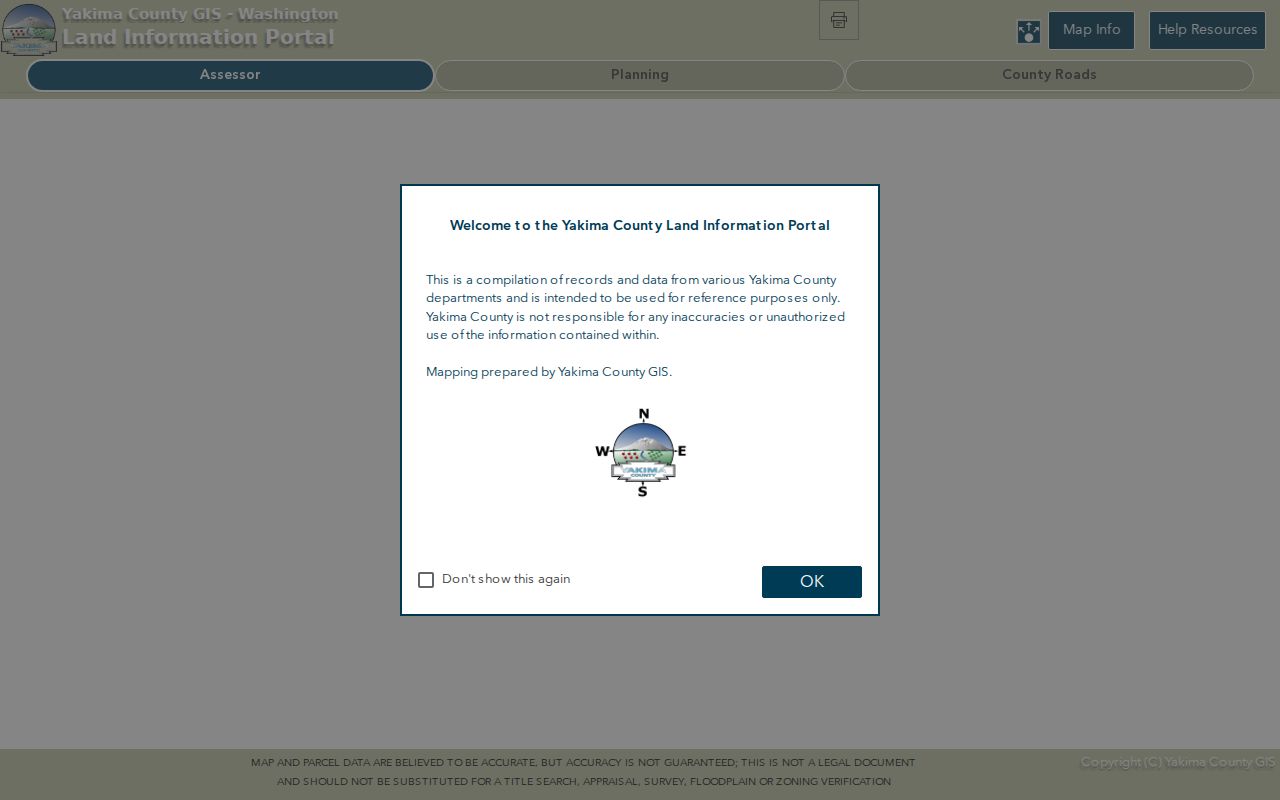
Open each parcel's Assessor record after a map click. Geometry discovers a lead; the custodian record verifies it.
CityMap provides another Yakima view. It can search by parcel, situs address, owner last name, or organization. Its identify and measure tools support map research, and planning layers include airport safety, floodplain, greenway, and master-planned development. The city warns that layers may not be complete or current. Some institutional and planned-development overlay information is absent.
Review the City of Yakima Planning FAQ before using its address and parcel instructions.
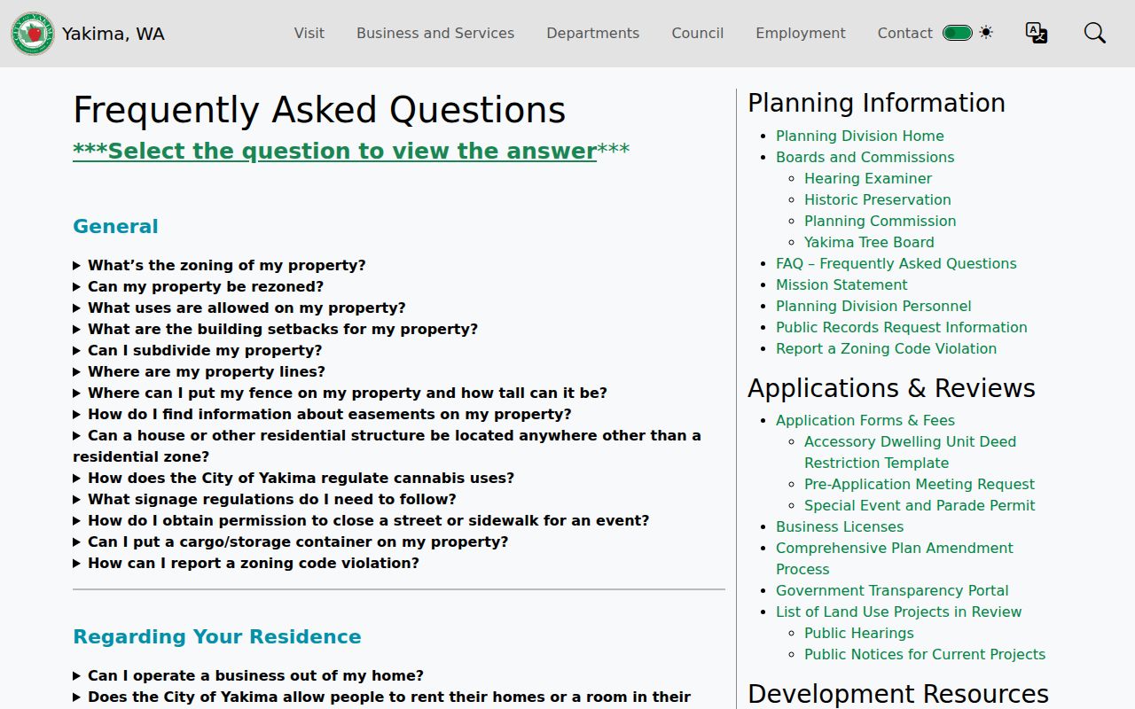
The city guidance helps translate an address into a mapped parcel, but the underlying Assessor and recorded documents remain the sources for ownership facts.
Read Yakima Address Terms
A few short definitions prevent the most common by-address errors:
- Parcel
- A county tracking unit for land. It is identified by a parcel number and may not match one postal address forever.
- Situs address
- The physical location assigned to the property. It can differ from the owner or taxpayer mailing address.
- Plat
- A recorded map that sets out lots, blocks, streets, and other subdivision facts. Its references can survive a street-name change.
- Criss-cross directory
- A historical directory arranged by street or phone number, allowing a reader to find a listed occupant from an address.
Keep the legal description too. A deed may use lot and block or a metes-and-bounds description instead of the street number. The legal text, parcel history, and recorded plat are more dependable than an informal address when a lot has split or merged.
Follow Yakima Street Deeds
The Auditor's Recording Division keeps deeds, easements, plats, surveys, liens, judgments, and other permanent records. The county document-research page points occasional users to its current online vendors and directs researchers to Room 117 for unlimited office work. Search a transfer in both directions. The grantor is the party transferring an interest; the grantee receives it.
Documents from February 23, 1997 forward are generally imaged. Records from August 1, 1985 through that date are electronically indexed but may require microfilm for the image. Earlier land work needs the office, deed books, plats, archive help, or historical-title research. Copies may be ordered online, by mail to the Auditor, or in person. An ordinary copy and a certified copy serve different needs, and current charges should be checked before ordering.
An Assessor excise entry can provide an excise number, grantor, date, price, type, and parcels sold. Carry that clue into the recorded index, then compare the image to the index. A lien, reconveyance, assignment, or easement may affect the land without proving that a named party lived on the street.
Check Yakima Streets for Permits
Permits add a building chronology to the street directory. Yakima County's documented ACA record scope begins in 1975 and covers work handled through building, fire, health, planning, roads, and water-resource channels. Weekly and monthly permit lists offer another route. Within the city, SmartGov publishes permits, land-use matters, inspections, notices, plans, and status details.
Portal roles matter. An application address can be the project site, while the mailing address belongs to a contact. An applicant may be an architect, contractor, owner, or authorized user. Code cases may redact a complainant or another protected field. Record the label displayed beside each name rather than turning every contact into a resident.
If punctuation blocks a permit search, retry the parcel number or a shorter street form. County Building and Fire Safety and the relevant city department provide a direct contact route when the public screen cannot identify an older file.
Yakima Street Labels Changed
A postal label is not a city boundary. Yakima addresses can sit inside the incorporated city, in an unincorporated pocket, or elsewhere in the valley while carrying a Yakima mail label. Confirm delivery with USPS, jurisdiction with CityMap or County GIS, and land identity with the Assessor and Auditor.
USPS changed Yakima label groupings in 2020. Codes 98902 and 98903 moved from a 98901 label to 98902, while 98907 and 98909 moved to a 98907 label. An older directory or mailed record may therefore look inconsistent with today's lookup even when the physical place did not move. Keep the source year and do not silently rewrite the older label.
Street-search tip. Preserve the original address beside every normalized form so a postal update does not erase a useful historical clue.
Crosswalk Historic Yakima Streets
Older records may say North Yakima, Yakima City, or Yakima. A proposed 2012 renaming of A Street for Sergeant Pendleton shows why a news item is not enough to prove a final change. No source in the Yakima research establishes one citywide street-number renumbering year. Confirm each suspected change through ordinances, plats, directories, deed descriptions, map sheets, and a focused records request.
The verified Library of Congress Sanborn set has 87 sheets for Yakima in 1920. It can show a building footprint, alley, warehouse, street alignment, or former use at block scale. Pair the sheet and original street label with today's parcel. The 1888 North Yakima directory and later library runs can then add dated names or occupations. The full collection details belong on the Yakima city directory page; here, the directory is a crosswalk tool for one street.
A name that vanishes after an address change may still belong to the same household or business. Record directory title, year, page, old address, new parcel, and the reason for the crosswalk. Mark uncertainty plainly.
Use Yakima Voter Streets Lawfully
VoteWA is designed for an individual registration lookup using first name, last name, date of birth, and verification. A broader Yakima County voter-file request can include authorized fields such as name, residential and mailing address, precinct, political jurisdiction, year of birth, registration date, and date last voted. County requests use a signed form, chosen district or history filters, and prepayment before production. The statewide extract is refreshed monthly.
That data is a dated civic layer, not a household census. It omits ballot choices, party preference, full birth dates in a public extract, and protected-address details. RCW 29A.08.720 restricts using voter lists for advertising, offers, and solicitations. A no-match may reflect a registration change, inactive status, confidentiality, or the search mode. Never fill the gap with an assumption.
Limits of Yakima Street Directory
A parcel system usually shows a recorded owner or taxpayer mailing contact. It does not list every adult, child, guest, delivery recipient, or other person connected with a property. Utility customer lists and protected driver-address data are not public substitutes. A deed party, voter registration, professional record, mailing address, or permit contact also does not prove that a named person occupies the site now.
Use the phrase “records associated with this address” unless a dated source truly establishes more. Compare at least two sources, retain the checked date, and keep each person's recorded role intact. Commercial people-finder products often merge old addresses and similar names without showing how a claim was formed. Official records are slower, but their custodians and limits can be checked.
Lawful use. Use Yakima address records for legitimate personal, family, property, historical, or civic research, never to track, intimidate, stalk, harass, or harm anyone.
The soundest street directory result may be a qualified conclusion: a parcel owner is shown on one date, a listed occupant appears in one directory year, or a permit names an applicant in a stated role. Those are useful facts without claiming a private, current roster.